FOR IMMEDIATE RELEASE
July 28, 2021
GRAND COUNTY ANNOUNCES COUNTYWIDE EVACUATION MAP
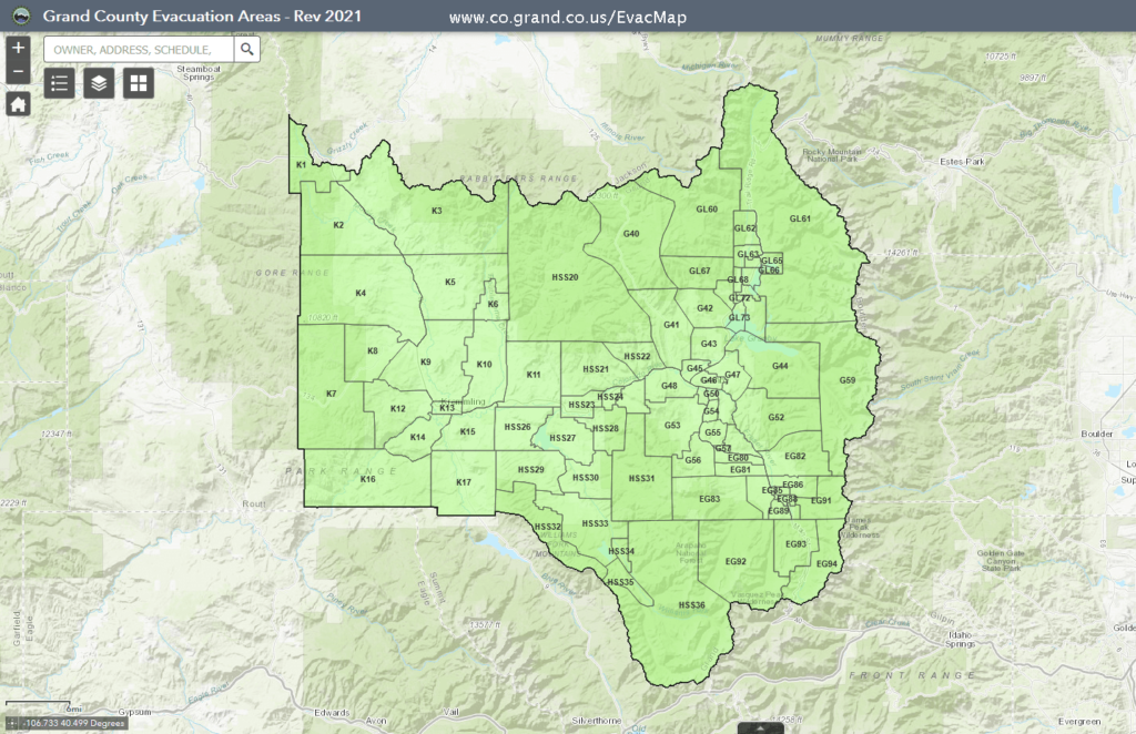
GRAND COUNTY, CO – In preparation for future incidents, the Grand County Sheriff’s Office in collaboration with the Grand County Office of Emergency Management, Grand County Road and Bridge Department, Grand County Geographic Information System, East Grand Fire Protection District, Grand Fire Protection District No. 1, Grand Lake Fire Protection District, Hot Sulphur Springs Fire Protection District, Kremmling Fire Protection District, Kremmling Police Department, Granby Police Department and Fraser Winter Park Police Department have jointly created a countywide evacuation map for Grand County that can be located online at www.co.grand.co.us/EvacMap.
One of the lessons learned from the 2020 fires was the importance of having evacuation plans prepared in advance. Unfortunately, when a fire or other emergency occurs it can be very fast paced, preventing sufficient time to review neighborhoods and infrastructure potentially impacted.
The evacuation map covers the entire county and divides locations into specific areas. The areas are labeled with a series of letters and numbers to allow for easy identification by both public safety officials and the public during an incident. Areas under no evacuation order will be displayed in green, areas under pre-evacuation will be displayed in yellow and areas being evacuated will be displayed in red. It is important to note that this new map replaces previously used evacuation area maps created in 2020 during the East Troublesome and Williams Fork Fires.
The Grand County Wildfire Council encourages homeowners to follow the three simple steps of the Ready, Set, Go! Program. Become Ready by taking personal responsibility and preparing your home before it is threatened by fire. Register your cell phone for emergency notifications through CodeRED. Get Set to act immediately and leave if evacuated. Follow evacuation orders and Go if you are directed to leave an area. Learn more about ways to prevent, prepare and survive a wildfire at https://bewildfireready.org.
The public is encouraged to become familiar with the map and utilize the search box to enter their address and view which evacuation area they live and work in. In an emergency, responders will reference specific areas and send notifications through CodeRED, Grand County’s cellular emergency notification system. For more information on how to sign up to receive CodeRED alerts visit www.GCEmergency.com.
###
